
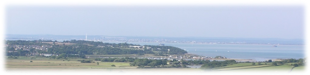
View from Culver Down
Blessed with a central Solent location, Seafarers SC is well placed as a base to explore a wide variety of locations by dinghy. Bembridge is generally the most eastern landfall for a day trip. This article hopefully gives a dinghy cruiser’s perspective on a visit to this wonderful location.
Notes by Clive Dakin
Location
Eastern end of Isle of Wight. For general location , find ‘Be‘ on Cruise Destination Map.
Lat/Long: 50°41′ 39.17″N, 1° 05′ 42.32″W (50.6942, -1.0951)
Google Maps: click here.
Reports of Previous Cruises to Bembridge
You will find reports of cruises to Bembridge within the Cruise Reports as follows:
- 2002: 20 July – Overnight Cruise
- 2017: 23 July – Cruise 4
- 2019: 25 August – Round Island and Overnight Cruise
- 2020: 20 September – Cruise
- 2021: 14 August – Cruise 6
- 2022: 28 August – Cruise 10A
- 2023: 8 July – Cruise 7
- 2026: 19 July – Cruise 7
Photographs of Previous Cruises to Bembridge
You will find albums of photographs of cruises to Bembridge within the Gallery Archive for 20 July 2002, 23 July 2017, 25 August 2019, 20 September 2020, 14 August 2021, 28 August 2022, 8 July 2023, and 19 July 2026.
Useful Links
Why go to Bembridge? It’s a stunning part of the island with sandy beaches and clear water.
How far is it? 10 Nautical Miles, therefore we can assume that it will take up to two hours to get there given that you are unlikely to set off without decent wind. If it looks like it is going to take much longer the trip is likely to be shortened to a closer location or abandoned.
Planning: You can only get useful access to Bembridge harbour at or near high water. Therefore the journey, for a day trip, needs to be planned for a day when HW Portsmouth occurs in the early afternoon. This will give you a fair tidal flow to Bembridge assuming that you leave Seafarers between 0930 and 1000. It will also give some tidal assistance for the return trip.
Route: On the two previous trips to this location (2016 and 2017) most of our cruisers sailed down the middle of the Solent on the outbound leg aiming for No Man’s Land Fort (the southernmost of the large forts in this area). You should be aware of Ryde Sands which extend furthermost out to the east of Ryde Pier. Having passed the Appley Tower folly (on Ryde Beach) if you can see Puckpool Point on your Starboard beam and the entrance to Portsmouth Harbour is in view on the other side of your boat you have passed the obstacle. I would advise passing very close to Seaview for the second half of the leg. By the time you get there the tide will be flowing against you. The trade-off for sailing close to this shore with its dense tree and building population is the gusty nature of the wind. Puckpool and, to a lesser extent, Seaview provides an alternative location to stop if insufficient progress is being made.
Approach: After Seaview you will sail past Seagrove Bay and Priory Bay. From the sea these will look as one large open bay. Once you are abeam of Nodes Point, before you get to the white painted tower of the old St Helen’s church on the shore line, you will be in an area of rocks extending out from the beach. At this point it is advisable to sail in the direction of the harbour entrance. The route into the harbour for larger vessels is constrained to a buoyed dog-legged channel. At high tide a dinghy can sail outside of this channel, indeed it is advisable to keep well clear of keel and motor boats at this point as they have very little options for course deviation.
Landing: Once inside the harbour you should consider turning sharp left (Port) towards Bembridge Sailing Club. There is a dredged channel running north of a line of moored Bembridge one design keel boats (pictured below). In this area there is very little room for manoeuvre but with forethought this will not be a problem. Once in the channel for the sailing club drop the mainsail as soon as possible. If the wind is from a southerly direction it can funnel down the harbour from the downs. The beach on the left as you face the sailing club is very sandy; however you will appear more capable driving up the beach in some control using the jib alone. There may also be expensive larger boats already present. The beach is usually without obstacles and made up of fine sand.
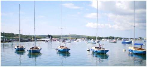 .. Boats moored just south of the beach used for landing with dinghies
Arrival: Well done, you deserve some relaxation. At the end of the sand dunes you will find the Tollgate Café. There is seating inside (if you are not too damp!) and tables outside. This establishment serves hot snacks, sandwiches, cakes and 1960’s style milky coffee! Just around the bend in the road opposite you will find the Pilot Boat Inn as well as public toilets. The main village is another half a mile up the hill. Here you will find a small Co-op and other shops and cafes including my favourite ‘The Bakery’ which is sadly not open on Sundays.
The Return Trip: You will likely wish to leave around one hour after high water at the latest to gain the advantage of the last of the west going tidal flow. The route will be governed by aiming to sail in the most favourable winds but basically after Seaview you should be able to make out familiar features close to our area on the mainland coast. If you are sailing in favourable tidal flow in a south westerly breeze, be prepared to get wet and take appropriate clothing. This is likely to be the coldest part of the journey.
Staying Longer: This area offers lots for a longer stay; if you like walking, scenery, pubs and live music this is the area to enjoy any or all of those. Camping would probably have to be arranged with Nodes Point Holiday Park which can be seen in the distance in the picture below (just to the left of the white building which is the old St Helen’s church). Camping on the dunes, of which the flat sections have been since converted to car parking, is possibly not practical if indeed allowed. Camping at Nodes Point is very expensive during school holidays.
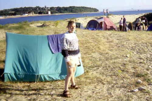 .. Overnight Cruise to Bembridge – July 2002