Notes by Clive Dakin
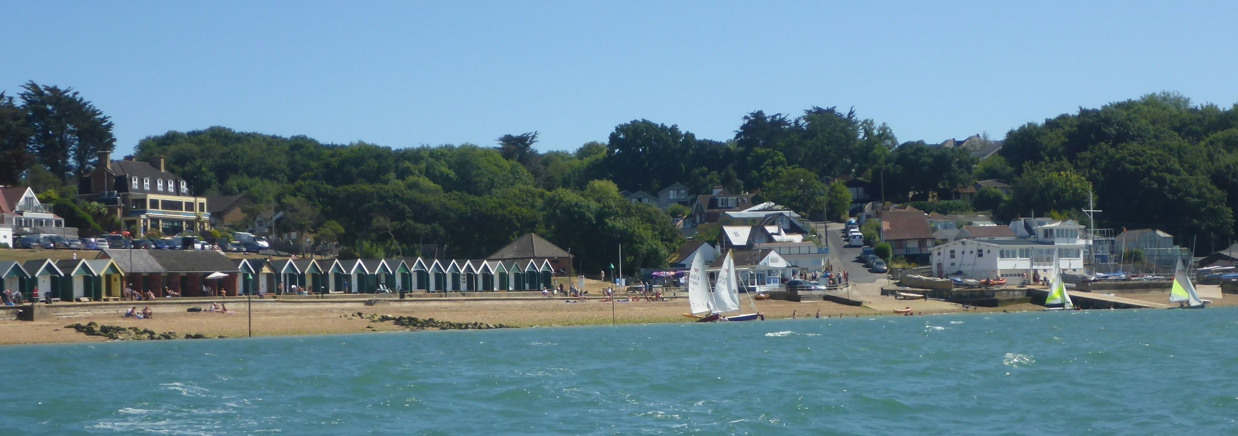
Gurnard is the first reasonably accessible beach southwest of Cowes and has good facilities for a pleasant stop.
Distance
6 nautical miles “as the crow flies” – approximately a 2 hour journey.
Location
Eastern end of Isle of Wight. For general location , find ‘G‘ on Cruise Destination Map.
Lat/Long: 50°45′ 39.35″N, 1° 19′ 28.03″W (50.7609, -1.3245)
Google Maps: click here.
Reports of Previous Cruises to Gurnard
You will find reports of cruises to Gurnard within the Cruise Reports as follows:
- 2006: 5 August – Cruise 8
- 2014: 22 June – Cruise 5
- 2018: 10 June – Ad Hoc, 4 July – Mid Week and 22 July – Cruise 4
- 2019: 26 August – Cruise 9
- 2020: 31 August – Ad Hoc
- 2021: 6 June – Cruise 3
- 2022: 8 October – Cruise 12A
- 2024: 5 May – Cruise 3
Photographs of Cruises to Gurnard
You will find albums of photographs of cruises to Gurnard within the Gallery Archive for 22 June 2014, 10 June 2018, 22 July 2018, 26 August 2019, 31 August 2020, 6 June 2021, 8 October 2022, and 5 May 2024.
Useful Links
Why go to Gurnard? It has a good range of facilities for a nice day out, a beach café, a pub that serves hot food, an ice cream kiosk and toilets. It has no shops within easy walking distance. There is a nice banked area where you can watch the passing boats. As it is so close to Cowes there are often interesting vessels to be spotted. The local sailing club has a good range of dinghies and the racing can be fun to watch from the elevated position of the bank. This destination also offers an introduction to sailing in the western Solent with the passage planning and navigation that requires.
How far is it? The direct distance to Gurnard is 6 miles however with our prevailing winds you are likely to be covering a much greater distance than this on either the outbound or return leg. Possibly up to three times this distance if sailing to windward.
Planning: Good planning is vital for this destination as is maintaining the departure times formed in that plan. Although not designated as such, one can consider Cowes Roads to be a tidal gate when sailing a dinghy. Therefore the tidal flow should be of primary consideration to your planning. The tides flow South West in the western Solent from one hour before HW Portsmouth until four hours after HW Portsmouth otherwise the tidal flow is North East. Therefore to provide a reasonable departure and return time for a day cruise the optimum time for HW on the day will be between 0900 and 1200 hrs. This will support a tidal flow assisted mid-morning departure and return journey starting at 1300 hrs or later.
Route: The outbound route is very much dependant on the wind direction and the tidal flow anticipated during the cruise with particular attention to the flow around Cowes Roads and the approach to Gurnard. If you are making good progress and in a favourable flow then staying on the island side of the channel offers stronger tide. If you have been delayed and anticipate the latter part of the journey to be against the flow then sailing over towards Calshot and thereafter in the main channel is likely to inhibit progress somewhat less.
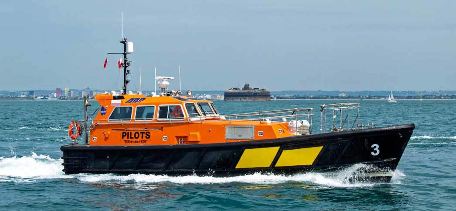
Navigation: Whilst sailing in this area you will encounter commercial vessels; Red Funnel car ferries, Red Jet ferries as well as large freighters and cruise liners. These vessels are constrained by their draught when sailing in the area of the Brambles Bank therefore they follow a specific route within the ‘Precautionary Area’ South and West of the Brambles Bank . This area is governed by the Moving Prohibited Zone (MPZ). This extends 1000m in front of and 100m either side of vessels over 150m. Larger vessels will be led by a Southampton Harbour Master boat (dark blue hull with yellow stripe). You will need to keep a lookout for all these vessels and plan your response as soon as you see them. Always ere on the side of caution and make your own decision not one based on what another boat is doing. If you have any doubts, plan to stay clear and pass astern.
Landing: Gurnard beach has a moderate slope and comprises large stones above the LW mark. The seabed below the LW mark is a mixture of stones and glutinous mud. There are several posts marked with Starboard lateral channel marker cones to the Cowes side of Gurnard Sailing Club. These denote the end of break waters made from large boulders. Once you have passed all of these you are clear to approach the beach.
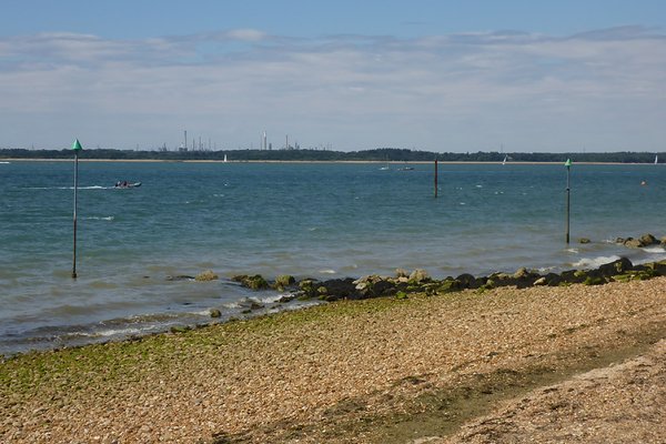
The above picture taken from Gurnard beach shows the channel marker posts. It is advisable to remain on the seaward side of these when approaching or departing the beach.
Mooring: There are two options for mooring, anchor or man-handle the boats up the beach using inflatable rollers. Based on the planning suggested above you will arrive on a falling tide. The nearer to LW you arrive the more confident you can feel about anchoring in the bay (Wind strength and direction being acceptable). It is advisable to use a good design and size of anchor. With reasonable onshore winds this is not a location best suited to folding anchors.
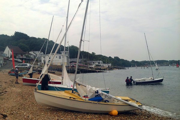
The above picture shows both methods of mooring. The sailing club is the light coloured building directly behind.
Refreshments and Domestic: “The Woodvale” PH is situated at the top of the grass bank behind the beach and serves a good range of hot and cold food. There are seats for 40 people outside and these are not bookable, therefore this provides a good chance of getting something to eat.
 .. The grassy bank behind the promenade with The Woodvale at the top.
 .. The Woodvale
The Watersedge Café near the sailing club was demolished in 2020, it was replaced by a mobile coffee and sandwich van which was still in place during our 2021 visit, however not open!
 .

Photographs of the Watersedge Café before and after demolition (with mobile van visible)
 .. Enjoying an icecream on the Gurnard promenade.
Toilet block and grassy bank visible in background. Note that you will now need a 20 pence coin to access the public toilets!
Return Journey: As stated in the Planning section above you will be returning in favourable tidal flow at four hours after HW Portsmouth. The stronger flow will be on the Cowes side of the channel however this may cause rougher seas depending on the wind strength and direction. The Calshot side of the channel offers less tidal flow if you require a quieter route.