Notes by Clive Dakin
Location
North coast of Isle of Wight approx. midway between Ryde and Cowes. For general location, find ‘W‘ on Cruise Destination Map.
Lat/Long: 50° 44′ 04.75″N, 1° 12′ 42.33″W (50.7347, -1.2118)
Google Maps: click here.
Reports of Previous Cruises to Wootton Creek
You will find reports of cruises to Wootton Creek within the Cruise Reports as follows:
- 2003: 23 April – Mid Week and 5 May – Cruise 1
- 2005: 26 June and 23 July
- 2006: 27 August – Cruise 11 and 17 September – Cruise 13
- 2007: 16 September Cruise 12 (Collision)
- 2012: 8 April – Cruise 1
- 2016: 6 August – Grand Cruise
- 2018: 3 June – Cruise 3 and 21 October – Cruise 7
- 2019: 7 April – Cruise 1
- 2020: 25 January – Ad Hoc Cruise to RVYC
- 2022: 17 July – Cruise 6
- 2023: 4 June – Cruise 5
- 2024: 9 June – Cruise 5
- 2025: 24 August – Cruise 12
- 2026: 3 May – Cruise 2
Photographs of Previous Cruises to Wootton Creek
You will find albums of photographs of cruises to Wootton Creek within the Gallery Archive for 16 September 2007 (collision en route!), 29 April 2011, 2 June 2013, 13 September 2015, 6 August 2016, 7 April 2019, 25 January 2020, 17 July 2022, 4 June 2023, 9 June 2024, 24 August 2025, and 3 May 2026.
Useful Links
Why go to Wootton Creek?
Wootton Creek is the closest Isle of Wight destination from Seafarers SC. It is a straightforward route and can be undertaken later in the morning if the wind is insufficient earlier in the day. It can therefore be used as a Plan B option if light wind inhibits a more distant destination. It’s also a good choice for the first cruise of the season and for new sailors/cruisers. The route planning is fairly simple and the landfall is protected from prevailing winds. There are options for refreshments in the area.
How far is it?
The direct distance to Wootton Creek from Seafarers SC is just under 5 miles; therefore you can expect the journey to take about one hour in reasonable winds.
Planning
Access to the creek and the landing site options is not limited by tidal height. The harbour entrance is dredged to allow access for the Wightlink car ferries. Therefore the only tidal consideration is to sail in favourable current for both the outbound and return journeys. To achieve this it is best to plan the trip on a day that the high tide occurs at 1400hrs or later. This will allow departure from Seafarers at 1100 hrs at the latest. A return journey departing as late as 1500hrs will still benefit from favourable tidal flow. On the return journey in a South Westerly wind expect a reasonable chop in the ‘wind over tide’ conditions. It is best to consider the clothing you take based on the assumption that the return journey will be colder if the outbound leg was warm.
Route
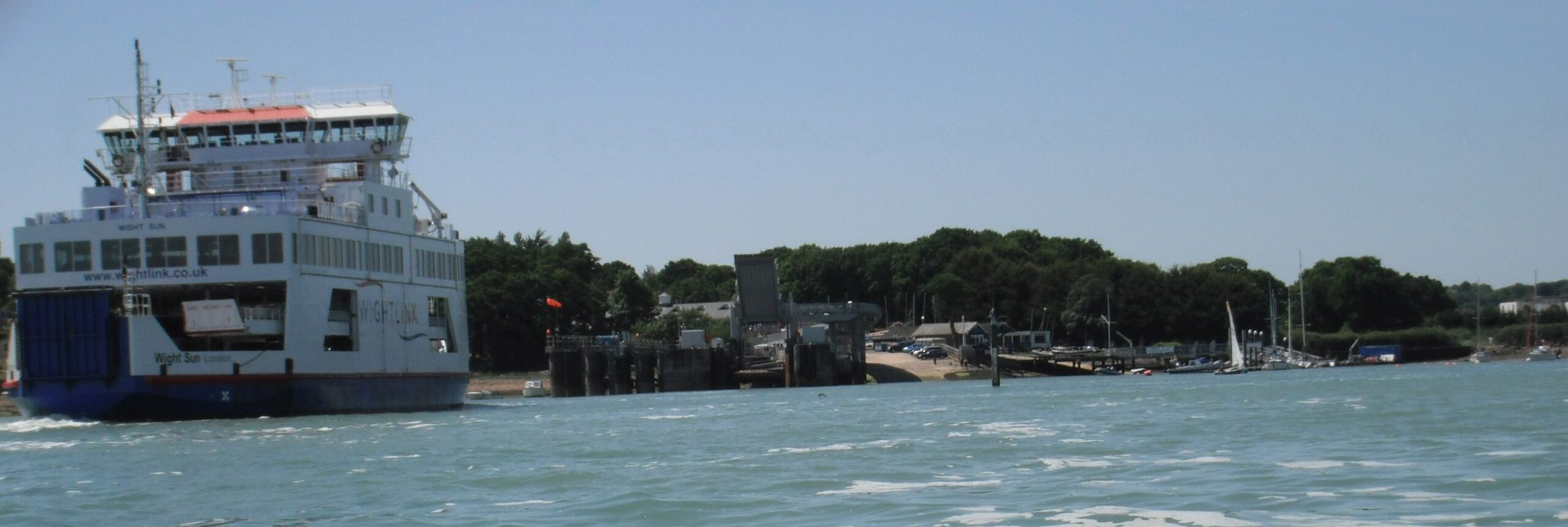
The entrance to Wootton Creek is usually visible from Seafarers by virtue of a Wightlink ferry being in the vicinity. In the outer approach to the creek you will see a small platform on the western side used for starting sailing races. It is advisable to pass this on your starboard side and make your way towards the marked channel leading into the ferry port. This will keep you clear of a small group of rocks on the western side of the channel. There is plenty of depth and space to sail adjacent to the marked channel on the Western side. As you approach the entrance you need to keep an eye over your shoulder for ferries approaching from Portsmouth. Expect to get close to the ferries and take the opportunity to wave at the passengers as you wallow in the confused air. They will reciprocate by serenading you with their car alarms!
Landing
Ostensibly there are two options for landing; The Royal Victoria Yacht Club or the ‘Private’ beach on the northern side of the ferry terminal.
The yacht club option is not quite so straight forward as there is limited space for numerous dinghies. The club is very welcoming to dinghies but prior arrangement would be needed to use the larger slipway which actually belongs to Wightlink but is available by a local arrangement. I am told that the club pontoon would attract a £5 fee, per boat for a lunch stop.
The beach is located on the left (East) bank of the creek just prior to the Wightlink ferry berth. The surface is made up of uniformly sized stones and has a gentle slope up to the high water mark. The best option for leaving the dinghies is to transport them up the beach as far as is practical using inflatable rollers. A bow anchor can then be taken and planted in the shingle at the high water mark. You are likely to need to check the status of your boat on a rising tide after one hour, depending on how far up the beach you have left it. Despite being stated as private I have not encountered any comments from locals on the last two visits.
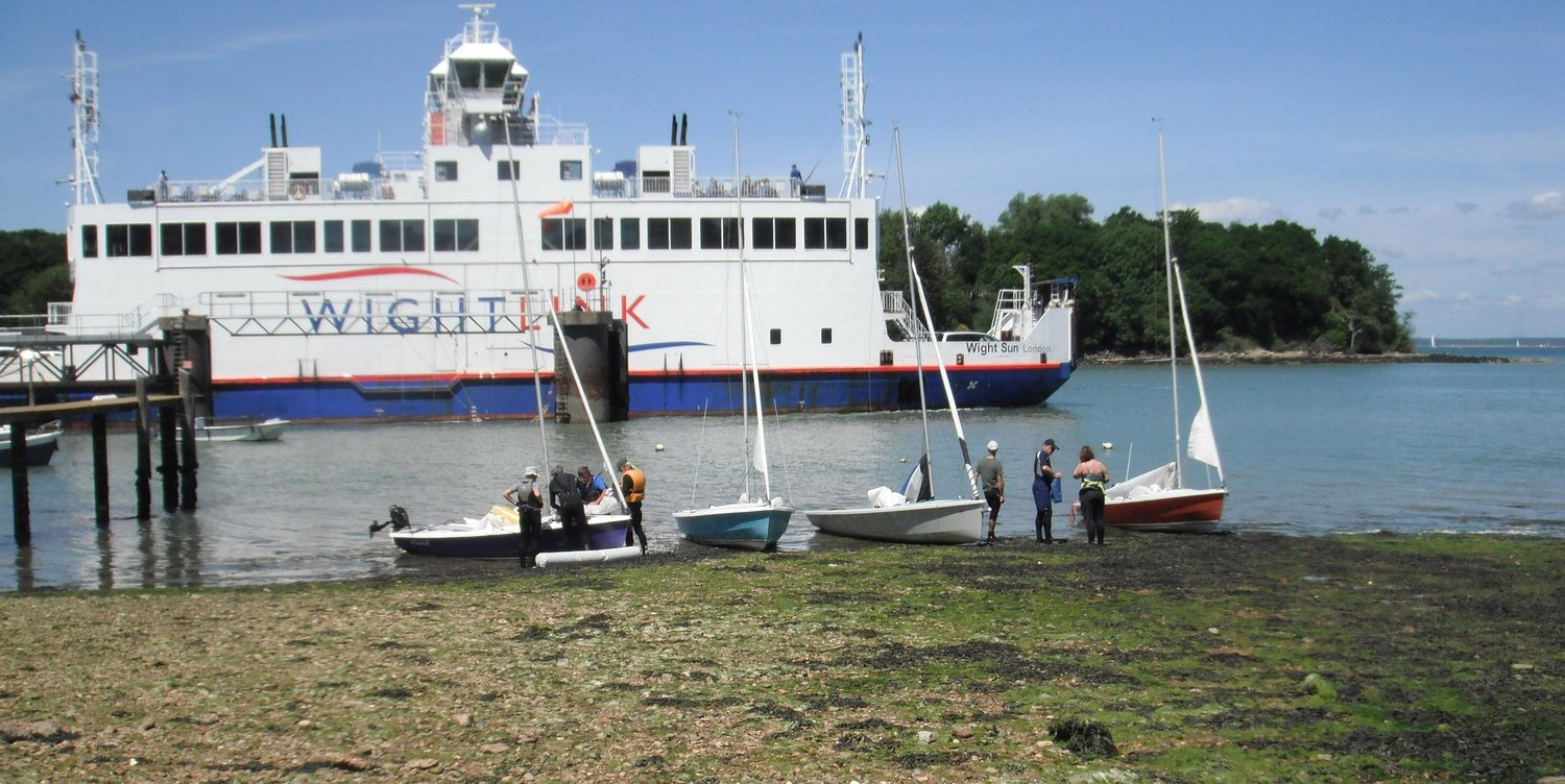
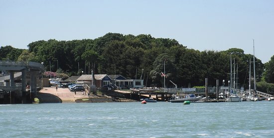
The small club slipway is on the other side of the walkway to the pontoon. The club pontoon is denoted by the piles with the white caps, the closest pontoon in this picture is private. The larger slipway shown on the left belongs to Wightlink but can be used if the yacht club is made aware of the intention in advance.
Refreshment
If you stop at the yacht club they have a galley with a comprehensive menu ranging from sandwiches to roast dinners, near the ferry ramp there is a café serving snacks and ice cream.
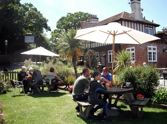
If you stop at the beach you are likely to be drawn to the local pub, ‘The Fishbourne’. This has a good range of ales and posh pub food. You need to budget for a spend of at least £14 for a pint and something to eat (2018).